The weather bureau is expecting “erratic motion” as Tropical Cyclone Zelia makes landfall, with warnings issued over extreme winds and significant flooding in the North West.
The large tropical cyclone has been classed as a category two system and was around 180 kilometres north of Port Hedland at 11am on Wednesday.
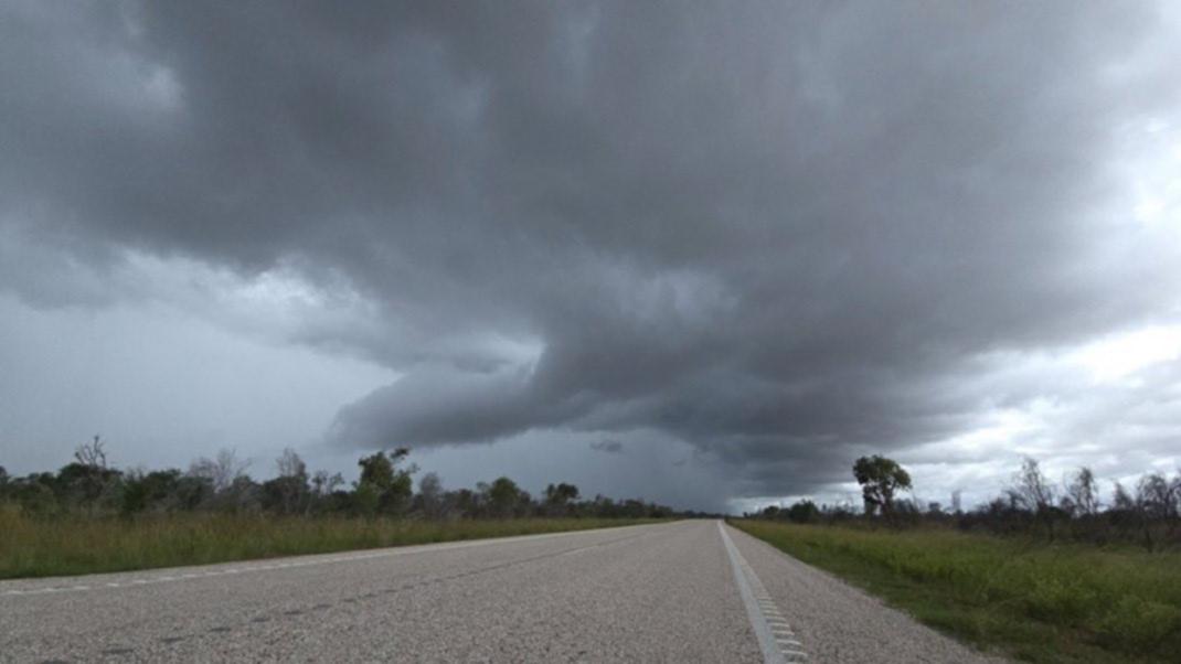
The weather system is forecast to intensify into a severe tropical cyclone before making landfall late on Thursday through Friday night.
Bureau of Meteorology WA manager James Ashley said areas between Karratha and Wallal Downs, including Port Hedland, were at the highest risk for the cyclone to cross.
He warned those in the Pilbara to expect wind gusts above 200km/h and rainfall over 500mm.
“We’re expecting erratic motion and there’s low confidence on the future path of the system,” he said.
“We appreciate that uncertainty is challenging for people dealing with this system in the north of the state but what we do know is that wind will increase (on Wednesday) across coastal parts of Pilbara, particularly in the East Pilbara, with destructive wind gusts in excess of 125km/h possible.
“Coastal parts could see elevated wind speeds for a prolonged period because of that slow motion of the system.
“If the system crosses the coast as a severe tropical system, we could see wind gusts in excess of 200km/h but regardless of intensity, we expect this system to produce very heavy rainfall and areas close to the path could see in excess of 500 millimetres over the course of this event.”
This very heavy rainfall will cause significant flooding, which is expected to shut major arterial roads including the North West Coastal Highway for up to a week depending on the damage.
Department of Fire and Emergency Services commissioner Darren Klemm said additional supplies were being sent to pharmacies and grocery stores as well as triple road train permits being established for extra supply trucks to get into the North West.

“DFES has significantly boosted its resources in the Pilbara and the Kimberley with additional personnel into our incident management teams in both Broome and Karratha, as well as operational on the ground personnel and rapid damage assessment teams into Nullagine as well as Marble bar and the Pilbara,” he said.
“We’re also bringing in additional capabilities like flood boats into the Pilbara over the course of (Tuesday) and (Wednesday) and (Thursday), where we also have additional aircraft on standby in the Pilbara for incident response efforts.
“Two rotary wing aircraft are based in Newman and one fixed wing aircraft is based in Karratha. We’ve also established a rescue helicopter capable of winching based in Broome.”
People living in the warning areas are urged to keep up to date through Emergency WA, which can be downloaded as an app.
The cyclone warning is currently at an advice level but is expected to escalate as Tropical Cyclone Zelia gets closer to the coast.
An evacuation centre will open in Port Hedland once the cyclone warnings are escalated to a watch and act level.
People have been urged to get ready for dangerous weather by preparing their home inside and out, including securing items that are outdoors, ensuring their emergency kit is complete and that they have a plan in place for when the cyclone hits.
Travellers, visitors, and tourists should stay informed about conditions and reassess their travel plans. Expect disruptions and check the Main Roads Travel Map for the latest updates.
Travellers in the affected area should consider leaving the warning area.
If driving, obey road closure signs and do not drive into water of unknown depth and current. Never walk, swim or play in floodwaters as they are dangerous.
For more information visit the Emergency WA website.