(This story has been updated with new information.)
A winter storm warning goes into effect in the Evansville and Henderson areas at noon Tuesday. Here’s what National Weather Service forecasters are saying about the incoming snowfall.
When will the snowfall arrive in Evansville and Henderson?
Although forecasters initially expected only a few flurries Tuesday morning, the city actually saw steady downfalls of snow Tuesday morning.
This evening’s winter storm will only add to that. According to an updated briefing from NWS just before noon, the heaviest bands will hit Evansville around 8 p.m. That’s slightly later than initially predicted, although the storm could still arrive ahead of schedule.
The snow will come to an end between 4 a.m. and 7 a.m. Wednesday.
How much snow is expected?
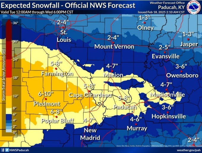
In Evansville, forecasters expect anywhere from 2 to 6 inches of snow. The heaviest amounts will be in places west and southwest of the Evansville area. In Southeast Missouri, for example, forecast totals range from 6 to 10 inches.

Updated snowfall forecast from the National Weather Service.
Will the snow be dry and fluffy or wet and heavy?
Snow texture is expected to be drier, the weather service said. North to northeast winds up to 20 mph may cause some drifting snow and localized areas of blwoing snow.
And then it gets cold, right?
Right. High temperatures for Tuesday will reach 22, with highs on Wednesday similar. But on Thursday, temps will struggle to clear the middle teens, and the Evansville area likely will stay below freezing until Sunday.
Wind chills Thursday morning could dip below zero.
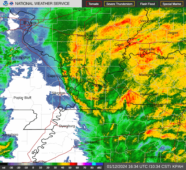
Evansville weather radar
This article originally appeared on Evansville Courier & Press: Winter storm in Evansville, Indiana