-
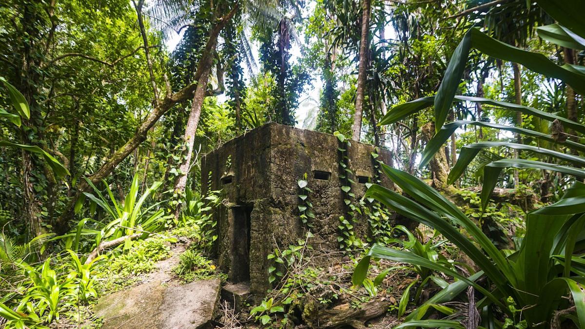
Researchers just imaged a 5,000-year-old fortification in the forests of Neamț County in Romania.
-
The study used drones equipped with LiDAR technology to capture the likeness of the structure through thick vegetation.
-
The fortification likely dates back to the transition from the Neolithic period to the Bronze Age.
Sometimes ancient ruins are hard to reach. Luckily for us, LiDAR technology can make researching some of those inconvenient places possible. LiDAR stands for “light detection and ranging,” and it works by rapidly emitting laser pulses toward the ground. The system then measures how long it takes light to travel to the ground and back again, using that time to calculate elevation. This data can then be used to create high resolution models.
In the past, LiDAR has helped image everything from tree growth to lost cities in the Amazon, and it just revealed something else incredible. This time, researchers were able to record an ancient fortified settlement deep in the forests of Neamț County, Romania.
“Thanks to current technology and using LiDAR scans I was able to obtain a faithful image of an almost 5000-year-old fortification.” Vasile Diaconu—an archaeologist on the study—said in a translated post. “On this occasion, we observed details that we could not observe in the field precisely because of the vegetation.”
The settlement roughly dates back to the transition from the Neolithic period to the Bronze Age. Researchers used noninvasive methods to image the sites, launching drones equipped with LiDAR to generate an aerial view of the fortifications. Diaconu argues that using these new technologies are essential parts of archaeological research.
“Only by using modern technologies will we be able to better understand the complexities of archaeological sites,” he said.
Findings from the study showed that the fortification was elaborate and well planned, suggesting that it likely took a great deal of work to build.
“LiDAR scans showed that most of the fortified sites were located in high areas, which had good visibility and were reinforced by ditches and even earthen mounds in order to increase their defensive capacity,” Diaconu said. “Field measurements indicated that some of these ditches had impressive dimensions with lengths of several hundred meters, which required considerable human effort in the construction.”
The project was a partnership between Geocad Services, Geo Edu Lab, and National Institute for Research and Development for Earth Physics—but it was also a collaboration between a past teacher and student. According to an earlier post, Diaconu received a message from his former student—Vlad Dulgheriu—who was interested in his archaeological work and just so happened to be the owner of Geocad Services, making the expedition possible.
“I’m honestly glad my former student has built his own road beautifully,” Diaconu said in the post.
How long until the student becomes the teacher?
You Might Also Like